nPoles is field-ready Windows software for overhead distribution powerlines. A job is a list of surveyed points, each able to carry pole, crossarm, insulator, conductor and stay data. From that one model nPoles works out the stringing charts, mean equivalent spans, clearances, pole loads and footing ratings, and produces the schedules and drawings that go to construction.
Two licences, one application
- nPoles Field — everything, including the live link to the total station. For the rugged tablet at the pole.
- nPoles Desktop — the same design, checking and reporting, for the office.
Survey at the pole
- Total stations on Bluetooth or cable. Leica, GeoMax and Sokkia instruments are driven from inside nPoles. The reading lands in the box being filled: pole top, circuit and insulator heights, conductor offsets, stays, on any of the 24 circuits a pole can carry.
- Reflectorless shots in 3D. A reflectorless read on a crossarm, stay or conductor keeps its full easting, northing and level with the job. Measured values show tinted, and a long press shows the shot, so a typed number never passes for a measured one.
- RTK GNSS. A receiver connects over the network or Bluetooth, with corrections from an NTRIP caster or from the surveyor’s own base, and fixed positions go straight into the job, with stake out, site calibration, short occupations and heights on AHD. A base check catches a base left running on yesterday’s coordinate before it shifts the whole job.
- The surveyor’s comps. Radiation and traverse by bearing, intersections, chainage and offset, peg bisect, closures, areas, transformations, swap and clone points, and temporary points to try an idea.
- Made for outdoors. High-contrast forms, tick boxes and radio buttons readable in daylight, an on-screen keyboard with the degree and diameter symbols, and dialogs that always open on a screen that is actually connected.
Build the model
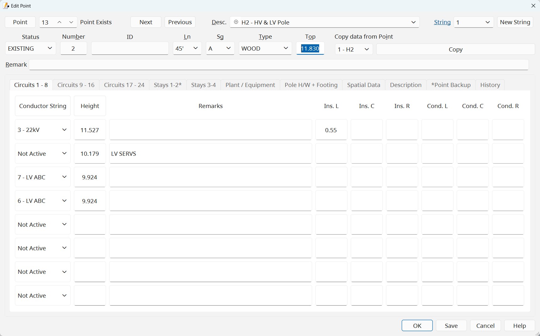
- The point editor. Pole, 24 circuits with left, centre and right positions, a remark per circuit, stays, footing, and plant and equipment. Description codes show their plan symbol and meaning.
- Strings. Point strings with names such as William St or kerb; conductor strings with their conductor and chart; phases strung separately and linked as a phase set.
- Survey in. LandXML from Topcon, Trimble, Leica and 12d controllers, text and CSV files, points from another nPoles job, and legacy POLES files, with the coordinate system checked and clashing strings asked about.
- Drawn on the map. Points added on the aerial image with a level looked up from the state’s elevation model; points generated along lines, arcs, circles and rectangles; building footprints; survey marks and boundaries lassoed into the job.

Conductors and stringing charts
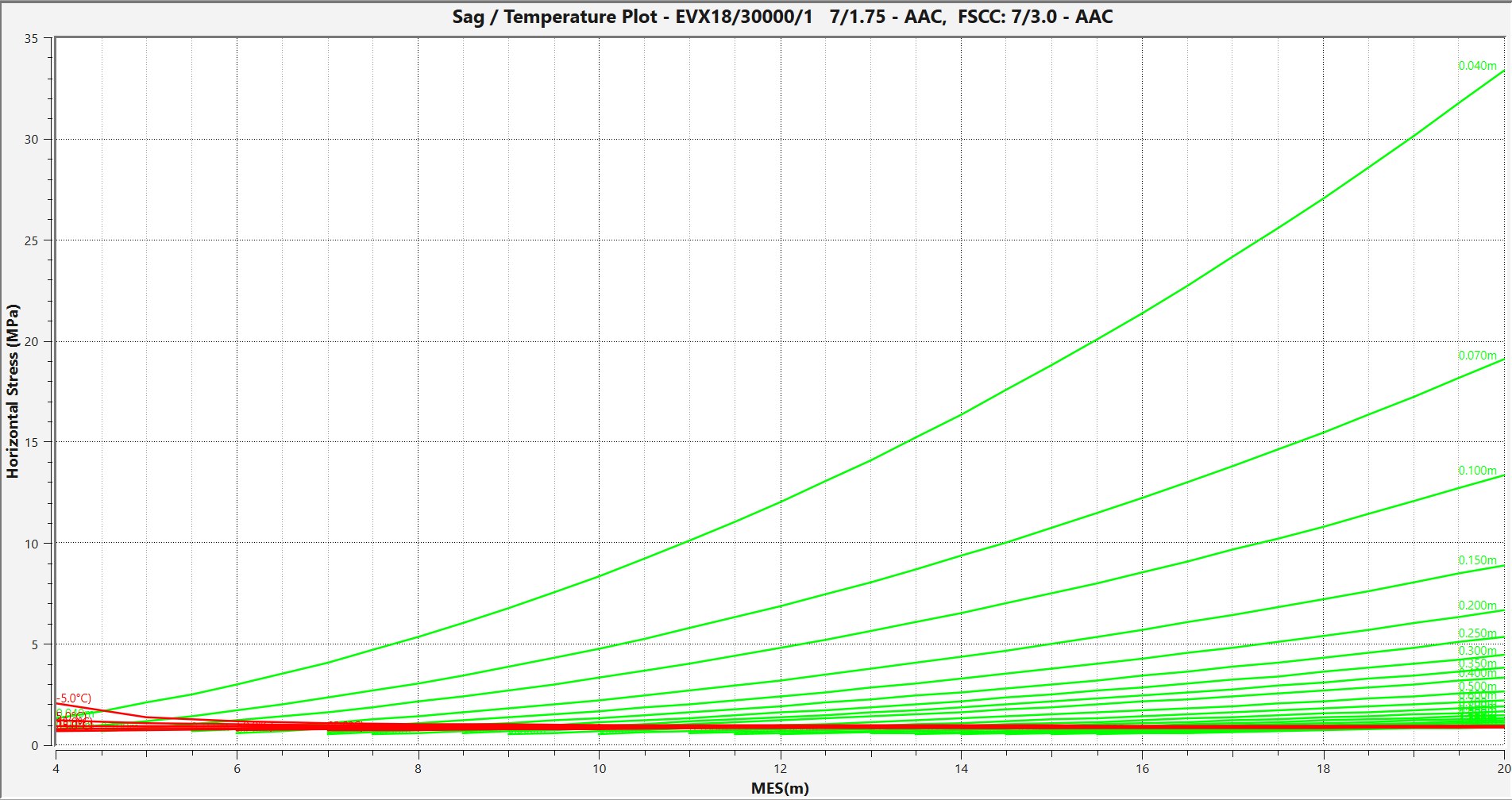
- Stringing charts from a nominal span or a percentage of breaking load; sag and condition charts over any range; crossarm separation charts; slacker charts for messenger cables; plots straight into CAD as an AutoCAD script or a FreeCAD macro.
- Chart libraries for each distributor, shipped in the company profiles.
- MES and ruling span with the inclined-span formula of AS/NZS 7000, route length, and conductor lengths stressed and unstressed.
- Chart Finder turns measured sags into the chart a conductor is actually strung to, phase by phase where the phases hang differently, and can create a chart from the average of what was observed.
- Conductor calculator for conductor properties, thermal rating and conductor temperature.
Design checks
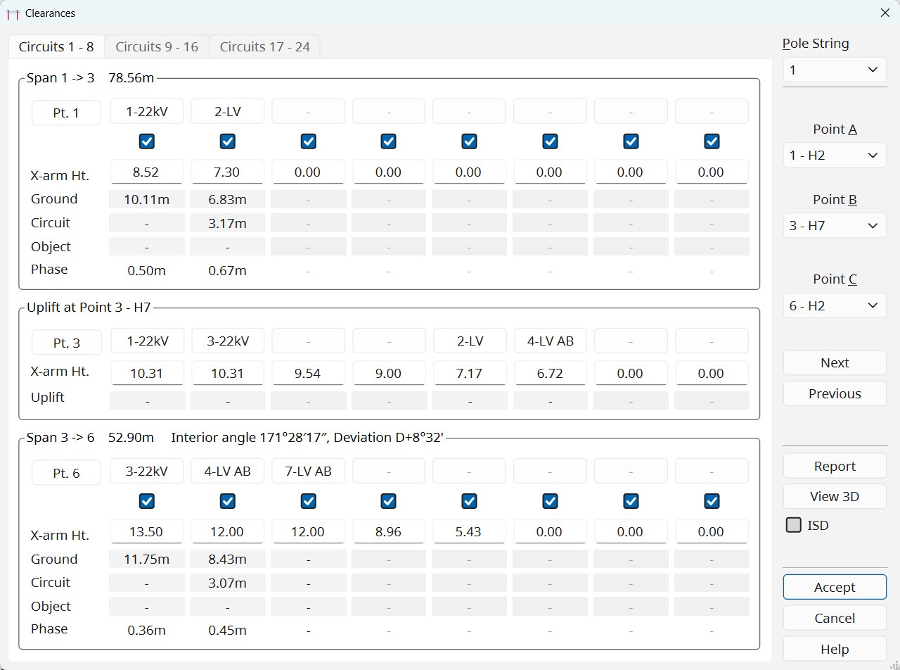
- Clearances to ground, objects and buildings, between circuits and between phases, mid-span and uplift, by MES or individual span design, on every circuit of every pole, including planned surface levels such as a road cut yet to be made.
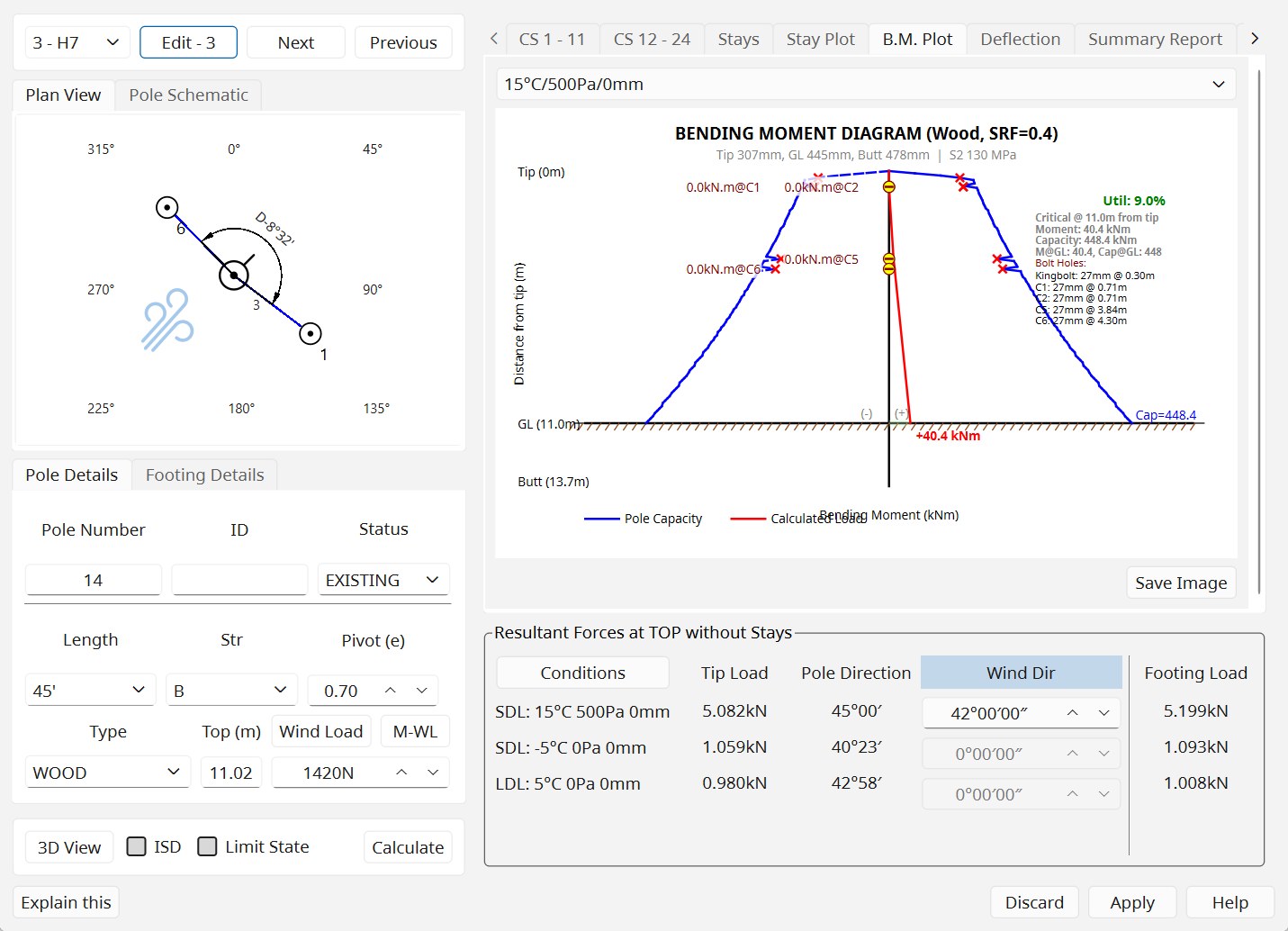
- Pole Load resolves the wind on the pole, crossarms, insulators and transformer, the conductor tensions from the charts and the stays, for the standard test conditions and any others. Bending moment and deflection diagrams against the pole’s capacity; timber strength from the species and the measured girth; timber, concrete and Titan poles; Design Stress or Limit State (AS/NZS 7000).
- Footings rated on every pole: the Victorian SECV (Devereaux) method and Brinch Hansen in single and layered soils, with soil profiles from a geotechnical report.
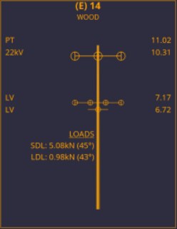
- Pole schematics in the style of a pole schedule, exported as an image or DXF.
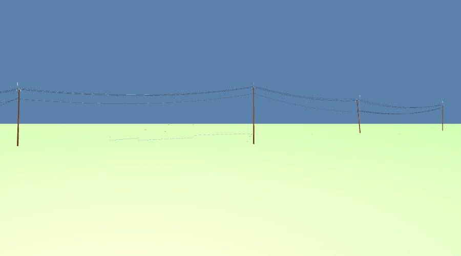
- 3D review. Route View 3D, PoleSketch 3D and Clearance 3D draw the line as surveyed. Click any object for its properties, each value marked surveyed, from the database or estimated, and measure between any two points.
Maps, marks and coordinates
- Basemaps: OpenStreetMap everywhere; aerial imagery for Victoria, New South Wales, Queensland and Tasmania; national maps for 17 countries; Street View a click away.
- Survey layers: survey marks and property boundaries for Victoria, New South Wales, Queensland, South Australia, Tasmania and the ACT, nearly 700,000 marks, with SMES sketch plans, road casements, cadastral corners and contours; New Zealand from LINZ; Switzerland from swisstopo and the cantons. Data licensed to the surveyor, such as Landgate’s, is added from the surveyor’s own GeoPackage.
- Datums done properly: GDA94 and GDA2020 through the official ICSM grid; AGD66 and AGD84; ground coordinates about a nominated origin mark; a job tied onto supplied control with every residual shown; Latrobe Valley mine grids as MGA references; New Zealand, Swiss, Irish, South African and worldwide UTM grids.
- Start from the address. An address looked up sets the datum and zone, frames the plan, and names the distributor whose area it is in, with that company’s profile.
Reports and drawings
- Schedules: the conductor schedule and the joint-use schedule.
- Job Change Report: every point and conductor string changed since its earliest backup, as PDF or spreadsheet.
- Pole Load detailed report as a PDF with the diagrams for every condition; Describe Point for where any point sits in the network.
- Exports: DXF; LandXML for stake out with any brand of controller; the plan view as an image or PDF; scaled plan printing. Construction plans through nPoles PPE.
The job is safe
Crash-proof saving. Undo for point changes, with a history that shows what each step will change. Point and conductor string backups with notes and a Diff. A job rebuilt from its survey log if the file is ever lost. A crash report offered after a crash, sent only on OK. Every message can be selected and copied into an email.
Company data and standards
17 company profiles. A Database Editor for poles, crossarms, insulators, timber species, transformers, description codes and plan abbreviations. Pole records that name the drawing their dimensions came from. Company data updates that merge with a business’s own edits instead of overwriting them.
Help inside the application
The reference manual opens inside nPoles (F1). The nPoles Assistant (Shift+F1) answers questions from the manual and about the open job, for registered users. What’s New lists the year’s changes in plain language.
What it runs on
- Windows 10 or 11, 64-bit.
- In the field: a rugged Windows tablet with a screen of 700 nits or brighter and Bluetooth for the instrument.
- In the office: any current Windows computer; a discrete graphics card helps the 3D views on large jobs.
- Every version installs side by side in one folder and updates through the maintenance tool, keeping data, settings and registration.